Tuesday, December 30, 2008

Anatomy of a Link: Understanding the Interface Process


Before I talk about how to interface a GPS receiver to a PC, you need to understand the types of data that can be passed between the two devices:
  • GPS receiver to PC: Saved waypoints, routes, tracks, and current location coordinates
  • PC to GPS receiver: Maps (if the GPS receiver supports them), waypoints, routes, and tracks
You can interface a GPS receiver to a computer and transfer data in two ways:
  • Cable: Most GPS receivers use a special cable, with one end that plugs into the receiver and the other that plugs into the serial or Universal Serial Bus (USB) port of your computer.
  • Memory card: Some GPS receiver models use Secure Digital (SD) or MultiMediaCard (MMC) memory cards to store data.
You transfer data between the GPS receiver and your computer with a card reader connected to the computer. If you use a Bluetooth wireless GPS receiver, you don’t need a cable or memory card reader to transfer data. These are designed to be used exclusively with laptops and PDAs
Avoid GPS receivers that can’t interface with a personal computer. The benefits of connecting to a computer far exceed the few dollars you’ll save.

About (Inter)Face: Connectivity Rules


If you choose to use a mapping GPS receiver (one that you can upload maps to from a PC), you’re in the right chapter. And kudos to you to getting a model that really lets you maximize using your GPS receiver. You’ll be outdoor navigating and geocaching in no time. Here are the very cool things you can do with a PC-compatible receiver:
  • Back up and store GPS receiver waypoints, routes, and tracks on your computer.
  • Download waypoints, routes, and tracks from your GPS receiver to your computer to use with computer mapping programs.
  • pload waypoints, routes, and tracks to your GPS receiver from other sources such as Internet sites, other GPS users, or mapping programs.
  • Upload maps from your computer to your GPS receiver (if your receiver supports mapping). For more on selecting a GPS with mapping capabilities.
  • Provide GPS data to a moving map program on a laptop for real-time travel tracking .
  • Update your GPS receiver’s firmware.

Internet connection for Digital Mapping Hardware


You need a modem and an Internet account if you want to
  • Download mapping software updates
  • Use Web-hosted mapping services
  • Download data for creating maps
An Internet connection is a must for anyone interested in digital mapping. If you plan to download digital maps and aerial photographs, you really should have a broadband Internet account (DSL or cable modem). Even when compressed, these files can be very large, and it can be painfully slow waiting for the data to arrive on a slower, dialup connection.

Monday, December 15, 2008

Communication ports


You can connect most GPS receivers to your computer through the computer’s serial port. If you want to download data from a GPS receiver to use with a digital map or upload maps and data to a GPS receiver, your computer needs a serial port and a special cable to connect the two devices. (Note: Some GPS receivers use a faster USB connector to interface with a computer.) If your computer doesn’t have a serial port, as is the case with a number of laptop computers, you need a USB adapter and serial cable to connect your GPS receiver to a computer. Read more about this in Chapter 9, also. If your GPS receiver supports both a serial connection and a Secure Digital (SD) or MultiMediaCard (MMC) memory card for storing data, use the memory card when you’re exchanging data. It’s both faster and easier to use than a serial cable when interfacing the GPS receiver to your computer. You will need a card reader connected to your computer to transfer data to and from the memory card.

Printers for Mapping Software


At some point, you’re probably going to want to print a digital map. Expensive plotters and large format printers are important for a professional mapmaker, but any printer that can output the map in a readable fashion is fine for the average computer user. However, some printers are more suited for digital mapping than others.
  • Color printers: Black-and-white printers are perfectly suitable for printing maps, but color output is usually easier to read and understand, especially when using topographic maps. A colored map produced on a cheap inkjet printer might be more useful than a crisp black-and-white map that came from an expensive laser printer. When cartographers make maps, they design them to be either black and white or color. Important information can be lost when a map program translates a color map into the inherent shades of gray in black and white.
  • Resolution: The higher the print resolution in dots per inch (dpi), the better the map will appear; especially for maps that show a lot of detail. Printers designed for printing digital photos work quite well in representing topographic and other detailed maps.
  • Print speed: Some printers are faster than others, and a faster printer means you get to see and use your printed map quicker. Printers are rated in pages per minute (ppm), which is the number of pages that can be printed in a minute. When you’re comparing page per minute ratings, be sure you look at the numbers for printing graphics instead of at text.
  • Cost per page: If you’re frequently printing maps, it makes good economic sense to use a printer with a reasonable cost-per-page rating (the estimated cost to print a single page, considering paper and ink). Cost per-page rates vary considerably between printers and are usually mentioned in magazine and online reviews.

Graphics cards and monitors for mapping softaware

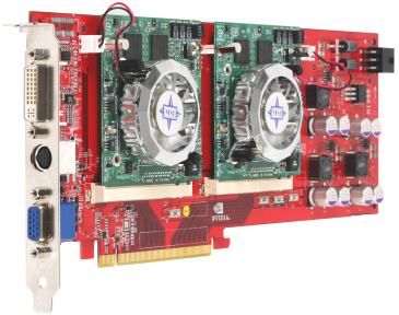
Unlike computer video games, graphics card requirements for mapping programs are pretty minimal. All you need is a Super Video Graphics Array (SVGA) card, which has come standard on computers for years. If your mapping software supports 3-D terrain display, a card that has a graphics accelerator will draw map images faster. An accelerator isn’t an absolute requirement because most commercial programs that support 3-D rendering take advantage of a graphics accelerator only if it is present. Check the specs of your current PC (or one you’re considering purchasing) to see whether an accelerator is present.

Just like the broad, general hardware requirements theme for mapping, bigger (that is, a bigger monitor) is better. Although most programs work fine on a 15-inch monitor, the larger the monitor, the more map area can appear onscreen. 17-inch monitors, which come standard with most computers these days, are more than adequate for digital mapping. However, if you’re spending a lot of time using maps in front of a computer screen, consider a larger (19-inch or 21-inch) monitor, which is both easier on the eyes and can display much more data.
In Windows, change the display size of a monitor via the Display Properties dialog box. To access this, right-click the desktop and select Properties from the contextual menu that appears. On the Settings tab, you can change the display area to different sizes such as 800 x 600, 1024 x 768, or 1280 x 1024 pixels. Try some of these different settings to see which works best for your mapping program as well as your eyes.

CD and DVD drives for Mapping Software


Just about every commercial software manufacturer uses CDs to distribute their products. Digital map manufacturers are no different; they extensively use CDs for map data. For example, the National Geographic Back Roads Explorer (a whopping 16-CD set) provides topographic maps for the entire United States. You can run these CDs on any CD drive; the higher the read speed, the faster the map data will load and display. Having a CD drive that can write (burn) CD-ROMs is way useful if you plan to download large amounts of map data from the Internet. Because data files can be very large, archive the data on CDs instead of cluttering your hard drive with infrequently used files. If you’re not going to be archiving map data, consider using CD-RWs (rewriteables) because you can delete files from them, using them again and again.
Computers are now commonly equipped with a DVD drive, which can read both CDs and DVDs. DVDs rock because they can store a whole lot more data than a CD; compare 4.7GB on a DVD versus a relatively paltry 700MB on a CD. As DVD drives become more commonplace on computers, expect map software companies to start offering their products on DVD media. This will make life easier for vendors who currently distribute map data on multiple CDs.

Hard Drives Requirement for Mapping Program


In these days of cheap, large hard drives, it’s easy to get a little blasé about storage space. Digital mapping can take up quite a lot of hard drive space, though, and you should be aware how much space your map software and its data can consume.
Software storage needs
A mapping program can easily install between 300–500MB on your hard drive, and that doesn’t count all the map data that’s contained on a CD. Depending on program options and the types of maps to be used, you can easily have up to 1GB of space taken up by a single mapping program. Always check the software hardware requirements to ensure you’ll have enough storage space to install the program.
If you’re running low on hard drive space, some mapping programs have a minimal install option that leaves some program data on the CD instead of writing it to the hard drive by default.

Data storage needs
Most commercial mapping programs come with map data on CDs, so you shouldn’t need to worry about storage space unless you plan on copying the map data on the CDs to your hard drive.
However, if you’re downloading lots of raw data from the Internet to create your own maps, you definitely need to think about your storage space needs. Map data is not small. For example, a single map data file can easily take up 5–10MB of space.

If you plan to collect lots of map data, you’ll definitely need a high-capacity hard drive for storage. At 10MB per data file, 100 files quickly can consume a gigabyte of disk space. Although you can get by using smaller hard drives, I’d opt for at least an 80GB drive.
If you decide to get serious about computer mapping, I recommend that you purchase a second internal or external hard drive to exclusively store your data. A second drive provides more performance and is easier to maintain and manage files. And because a second drive currently can be had for a little more than a dollar per GB, the bigger the better.